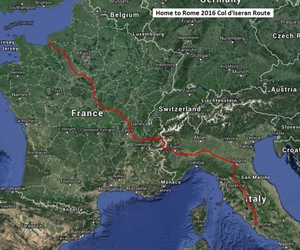
Inspired Living’s 2016 challenge is to ride 1842 km (1140 miles) to Rome. Over 40 riders, with a support team of 7, will cross the English Channel, ride through France, go over the Alps and then cruise down to Rome via Turin, Bologna and Florence. This will take 2 weeks and the riders are covering the cost of all their own accommodation, ferry and plane travel, so that all the money they raise can go to CRUK.
This is the fifth continental ride organised by Inspired Living. Veterans of previous rides are making the trip together with some new faces of all ages. They are all driven by the desire to promote healthy living whilst raising money for a charity which they are all committed to. Please give what you can to support them.
Participants
Please click on this link to download the Rider Information Pack _ Home to Rome V1.0
Route Notes
With the departure date fast approaching here is the detail for the Home to Rome route. The files are as follows:
• A zip file containing a gpx track for each day. There are 16 files within the zip file; days 1 to 14, the UK bit (Winchester to Portsmouth), and an alternative for day 7 which goes over the Col de l’Iseran instead of following the main route up the Col de Mont Cenis.
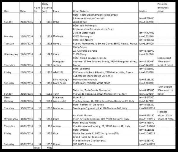
• An excel spreadsheet containing detailed information about the route, towns, distances, waypoints, elevations, hotel details plus a few notes.
• A pdf file listing the waypoints and their latitude and longitude.
• A set of notes providing guidance on how to load the gpx track files into a well known route planning website so that the route can be studied in detail. Guidance on how to load the track files to some Garmin devices is also provided.
All riders need to unzip the tracks and load them all onto their gps devices. Once loaded double check that they are all actually loaded (some gps devices are a little temperamental and do not always properly process a large batch of tracks loaded all at once, consequently not saving some of the tracks which have been loaded).
Study the spreadsheet information; it is recommended that you print it out and/or load it to your smartphone for reference on the ride.
The pdf listing of waypoints is supplied primarily for use by the support team who will be navigating using car type satnavs.
General Information
With riders having the option to do all or part of the ride, the table below indicates possible places to join/leave the ride.
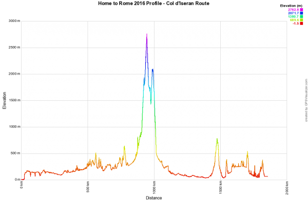
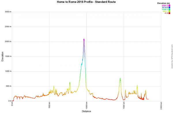
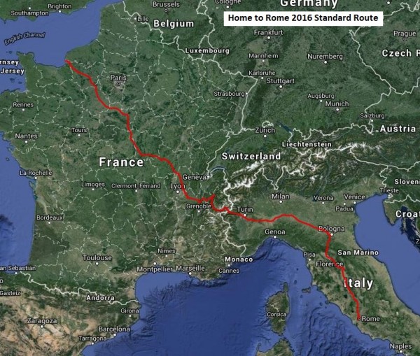
Below are the latest route maps and profiles to give you a flavour of what lies ahead.
On Saturday 27 August you can go a bit higher depending on how your legs feel!
